Challenge
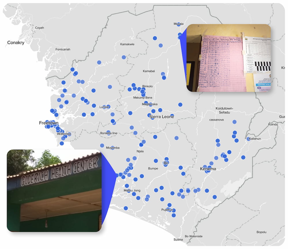
A global NGO focused on building spatial data solutions to achieve development goals works with countries to generate, validate and use geospatial data on population, settlements, infrastructure, and boundaries. To support Sierra Leone’s Ministry of Health and Sanitation system of record keeping, this NGO sought Premise’s help validating existing health facility location data and collecting location data for those facilities without location information.
Solution
For the process of validating healthcare facilities, Premise leveraged both the broader public network of Contributors in Sierra Leone, as well as building and training a subset of Contributors to travel and validate facilities located in rural parts of the country. To validate a healthcare facility with known geographic information (latitude and longitude), Contributors were asked to:
- Confirm the accuracy of the location information (lat/long) for the given health facility
- Confirm the correct name of the facility
- Take a photo of facility signage and the structure itself
- Confirm the type of facility
- Report on the operational status of the facility
To validate a healthcare facility with no known geographic information, Contributors were asked to:
- Travel to a chiefdom (Administrative level 3) of the facility and locate the facility
- Collect the location information (lat/ long) for the given health facility
- Confirm the correct name of the facility
- Take a photo of facility signage and the structure itself
- Confirm the type of facility
- Report on the operational status of the facility
Findings
The team found that many of the official healthcare facility records required updating. Of the over 700 facilities mapped by Premise Contributors, nearly 30% had incorrect names. However, of those with location information, only approximately 5% of location information was inaccurate and nearly all the facilities validated were operational.
Of the health facilities without location information, approximately 15% were not located within the chiefdom administrative boundaries where they were believed to be located. Therefore, more work is required to determine if the health facility records are incorrect or if these health facilities no longer exist.
The NGO partner team also discovered the utility of using mixed methodologies and technologies to inform their support of authoritative systems of record for various sub-Saharan African governments. Particularly, the team used a combination of local expertise, in the form of community health workers, along with local knowledge from Premise Contributors to more accurately isolate and target data collection strategies for validating and updating official infrastructure records.
Implications
Premise Contributors validated over 700 health facilities across Sierra Leone. Once the data was collected, the NGO harmonized the health facility location data with existing authoritative records of Sierra Leone’s Ministry of Health and Sanitation. The Ministry of Health and Sanitation now owns this data, which can be utilized for more complex data collection down the road and to support micro-planning efforts or future service delivery initiatives.
With a greater understanding of Premise’s capabilities, the NGO continues to use Premise to expand its technological approaches to contribute to human settlement mapping initiatives in Sierra Leone and elsewhere.
